


Earthquake rattles Vancouver
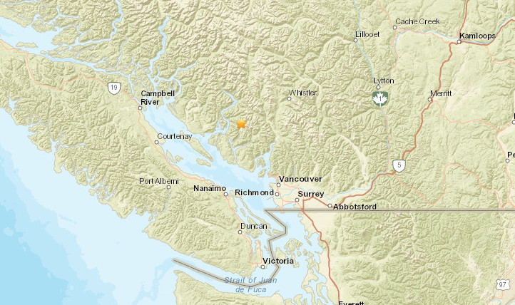
An earthquake registering 5.1 on the Richter scale has struck off the coast of British Columbia, approximately 36 km northeast of South Pender Harbour and 55 km northeast of City of Vancouver. The seismic event occurred at 1:26 PM local on February 21, 2025, at a relatively shallow depth of 2.0 kilometres.
The earthquake’s epicentre was located at 49.874°N 123.696°W, in the Strait of Georgia region between Vancouver Island and mainland British Columbia. This event follows a smaller 4.7 magnitude earthquake that occurred earlier in the same region near Sechelt.
Initial community response data shows limited citizen scientist contributions, with only three felt reports recorded so far. The United States Geological Survey (USGS) has generated a Community Internet Intensity Map to track the earthquake’s impact on local residents.
The location of the earthquake, in the seismically active Pacific Northwest region, is part of the Cascadia Subduction Zone. While earthquakes are not uncommon in this area, the shallow depth of this event makes it particularly noteworthy.
Local authorities have not yet reported any damage or injuries. Residents in Vancouver, Seattle, and surrounding communities may have felt the tremor. The Pacific Northwest Seismic Network continues to monitor for any aftershocks.
This is a developing story, and updates will be provided as more information becomes available.